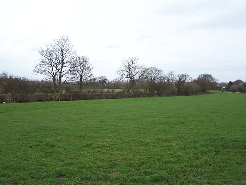
Wall Mile 61

Wall Mile 61 [HB 336–7]

The line of the Wall is now closely followed by the continuation of Birky Lane, the curtain wall lying just to the north of the road itself.

Lane on line of the Wall

Lane on line of the Wall

Just over half way along this stretch, the course of the ditch becomes apparent to the left and then, soon after, we rejoin the course of the National Trail, which comes stomping up from Low Crosby, where it has briefly followed the course of the Stanegate out of the village before crossing the busy A689 by means of a bridge shared with (but, on either side, segregated from) a farm track. At the point of the reunion, immediately to our south, a series of temporary camps are known from aerial photography, possibly labour camps associated with the construction of the Wall, although they may equally be associated with the passage of troops along the Stanegate. Continue eastwards, enjoying the easy walking provided by the leafy lane, making for the site of Milecastle 61 (Wall Head).

Milecastle 61 (Wall Head) [HB 336; haiku]

Looking towards the site of Milecastle 61

Looking towards the site of Milecastle 61

For some curious reason, the position of Milecastle 61 is not marked on the 2010 edition of the English Heritage map of the Wall, but we can be reasonably certain it lies slightly east of Wall Head farm and, indeed, geophysical survey has identified its likely position.

Seditio3ad

Wall Mile 62

Wall Mile 62 [HB 337–8]

 From the A689 as far as Walby, the course of the Wall is marked by the familiar field boundaries and is inaccessible, so we must retrace our footsteps to the roundabout, then head east for about 0.9km until we reach the junction with Birky Lane, which will take us north up to the suggestively named Walby. The lane kinks and jiggles until it rejoins the course of the Wall near Walby Grange, where the frontier has undergone a major course change onto a more easterly bearing, parallel to the line of the Stanegate to its south.

Milecastle 62 (Walby East) [HB 337; haiku]

Site of Milecastle 62

Site of Milecastle 62

Milecastle 62 (Walby East) was located by MacLauchlan at the point where the lane, which has made a short detour to the north of the Wall immediately after Walby, turns eastwards once more. In 1999, tests excavation identified the heavily robbed remains of the long-axis milecastle, as well as its turf predecessor. There are no visible remains.

Wall Mile 63

Wall Mile 63 [HB 338]

 Immediately after the site of Milecastle 64, the wall is breached by the cutting of the M6 (in 1970, when it was constructed, no preliminary archaeological work was undertaken, as was so often the way back then). Continuing alongside the B6264, we soon approach the junction with the A689. Prepare yourself for some brief excitement, as the Wall ditch can be made out crossing Brunstock Park as a conveniently delineated enclosed area of rough ground running across the arable fields. We can view this (but not, note, venture onto it) from the western end (by walking a short way up the unclassified lane towards Brunstock – it can be glimpsed to the right just before we reach the first bend) or, more clearly, from the east (by walking up the western verge of the A689 north of the roundabout, the ditch appearing to the left opposite the entrance to a small lane on the right). Although the course of the Vallum is marked as extant at this point on the English Heritage map, it is not apparent on the ground as an earthwork, so don’t bother looking for it.

Line of the ditch

Line of the ditch

East of the A689, the Wall continues as a hedgeline running towards the hamlet of Walby. We cannot follow this so are forced to proceed east along the A689, still following the Military Road.

A hedgerow follows the Wall

A hedgerow follows the Wall

Milecastle 63 (Walby West) [HB 338; haiku]

Maclauchlan thought he could discern Milecastle 63 (Walby West) to the north of Wallfoot but modern resistivity survey has been unable to verify its location and the English Heritage map petulantly omits it.

CGHad

Wall Mile 64

Wall Mile 64 [HB 338–40]

After Milecastle 65, the footpath takes us through Tarraby and out the eastern side. As we head south-east down Tarraby Lane towards its junction with Haughton Road and the B6264, we can look to our left and see a hedgerow with trees following the line of the curtain wall. We, however, must make our way down to the B6264 (which is actually the old 18th-century Military Road) and head eastward, mostly using the verge, although there are a few places where some pavement has thoughtfully been provided.

The line of the Wall as a hedgerow

The line of the Wall as a hedgerow

This is scarcely the most exciting part of our journey, for the Wall proceeds under the site of the former Hadrian Camp army base way off to our left.

Tarraby to the right, the former Hadrian Camp near the centre, with the M6 snaking past

Tarraby to the right, the former Hadrian Camp near the centre, with the M6 snaking past

Milecastle 64 (Drawdykes) [HB 338; haiku]

Although MacLauchlan failed to find it, the site of Milecastle 64 (Drawdykes) now sits perched on the western edge of the M6 embankment, within the former army camp. It was excavated by a serving army officer in 1962 and found to be a short-axis example. Part of an inscribed milestone was also found. There is nothing to see now.

Wall Mile 65

Wall Mile 65 [HB 340]

As we climb the hill from the modern bridge over the Eden (probably itself on the site of a Roman road bridge), we fork right along the B6264 Brampton Road and can reflect upon the fact that this junction represents the western end of the 18th-century Military Road which we shall be encountering again later and about which there is much more to be said.

Around 200m along the road we can cross over using the pedestrian crossing and enter the churchyard where a piece of signage provides some details about the fort of Stanwix, which is appropriate, since we are now standing next to the south-west corner of it.

Stanwix fort (VXELODVNVM)

Stanwix fort lies north of the Eden and, with around 800 troopers, was the base of the largest cavalry unit on the Wall (and, indeed, in Britain), the milliary (literally ‘1000-strong’) ala Augusta Gallorum Petriana. Not much is known about the site, since it is situated under one of the suburbs of Carlisle. It covers 3.27ha (9.32 acres) and appears to have had both turf-and-timber and stone phases, the former built after Hadrian’s Wall had been constructed in stone here, and is located 8.9km (5.5 miles) from Burgh by Sands. There is not much for the visitor to see, but enough to make it worth the effort.

Stanwix churchyard

Stanwix churchyard

A sign in the churchyard tells us that the south corner and its corner tower were located there. Continuing up the path, past the church (built of Roman stone, naturally), we turn right onto Church Street, then take the second left onto Knowe Terrace, then left again onto Mulcaster Crescent. Before the end of the street we see the car park entrance to the Cumbria Park Hotel. In the far left corner of the car park, part of the course of the fort north wall has been marked out and an explanatory plaque provided. Now might be an opportune moment to revive yourself with the beverage of your choice in the hotel before heading off along the Wall again.

Line of Stanwix fort wall

Line of Stanwix fort wall

Retracing our steps along Mulcaster Crescent and Knowe Terrace, we must now turn left along Kell’s Place and then, as it begins to bend round to the right, take the left-hand road (Tarraby Lane) past the back of the University of Cumbria, on our right, and head for the trees ahead, in the distance. As we reach a sign labelling Beech Grove you will note that a footpath carries straight on. This, as if you had not already guessed, is the line of the curtain wall, the ditch being virtually completely ploughed out in the field to our left. The path leads us up to a course realignment on the crest of a hill then drops down again to cross a stream, before climbing again gently towards Tarraby, the hedgeline on our right marking the course of the curtain wall. On the way, we shall pass the site of Milecastle 65.

Line of the Wall east of Stanwix

Line of the Wall east of Stanwix

Milecastle 65 (Tarraby) [HB 340; haiku]

Milecastle 65 (Tarraby) has been located by geophysical survey and one of its walls confirmed by excavation but nothing remains to be seen above ground. An altar of Cocidius allegedly comes from near here. This is not the last time we shall encounter this pre-Roman hunting god who came to be identified with the war and hunting god Mars and the woodland deity Sylvanus.


Looking towards the site of Milecastle 65

Looking towards the site of Milecastle 65

PLVad2

Wall Mile 66

Wall Mile 66 [HB 347]

The Wall now crosses former railway yards whilst the Trail, diving under an old railway viaduct, hugs the riverside, ultimately arriving at Bitts Park, on the floodplain of the Eden and just north of Roman Carlisle.

Carlisle from the air

Carlisle from the air

The fort at Carlisle (Luguvalium) was never part of the Hadrian’s Wall system, but was rather connected to the ‘Stanegate frontier’ (itself a notion which regularly comes into, and then goes out of, fashion). The redevelopment of the city centre has seen large portions of the extramural settlement and the southern portion of the fort being excavated (the northern part is situated under the castle, which is still Crown property), the earlier levels showing a degree of organic preservation second only to Vindolanda. It has the distinction of its first fort being dated very precisely to AD 72, thanks to dendrochronology, and there is then a cycle of renewal approximately every ten years, with the garrison probably changing each time. Writing tablets (similar to, but less famous than, the Vindolanda examples) mention the presence of ala I Gallorum Sebosiana in AD 105. Like the Roman fort at Corbridge, its later garrison included detachments from the three British legions, II Augusta, VI Victrix, and XX Valeria Victrix.

The curtain wall crossed the Caldew and then the Eden by means of stone bridges and Camden observed that ‘within the chanell of the river mighty stones, the remaines thereof, are yet extant’. This lay just downstream of the bridge that carried the Roman road to the outpost fort at Netherby across the Eden and through the Wall (probably with a gateway like that at Portgate, north of Corbridge). Stones from one (or more) of the bridges can be seen in Bitts Park, just after crossing the bridge over the Caldew, off the path to our left.

Stones from a Roman bridge in Bitts Park

Stones from a Roman bridge in Bitts Park

After Bitts Park, the National Trail continues along the south bank of the Eden before crossing the river, but we are going to deviate and cross by means of the road bridge, about 200m from the site of the Roman bridge carrying the Wall, so that we can keep more closely to the line of the frontier and explore the neglected remains of Stanwix fort.

Milecastle 66 (Stanwix Bank) [HB 346; haiku]

Site of Milecastle 66

Site of Milecastle 66

Milecastle 66 (Stanwix Bank) – to the left as we cross the bridge – was noted by Thomas Pennant in 1772 on his way north to explore Scotland again. He saw it perched on the edge of the north bank of the river, recording ‘vestiges of some dikes describing a small square’ but no trace now remains.

Wall Mile 67

Wall Mile 67 [HB 347]

Once on the east side of Boomby Gill, we are now nearing Carlisle, but first we have the inestimable joy of our first sight of the Vallum. Just before we reach the pylons, its earthworks are visible off to our right, subdued but there nonetheless. The Vallum originally consisted of a broad flat-bottomed ditch 6m (20 Roman feet) wide and 3m (10 Roman feet) deep, flanked by mounds to its north and south formed from the upcast. Both mounds were separated from the ditch by a 9m (30 Roman feet) flat strip or berm. The name Vallum is modern, reflecting a name given to it by Bede in his Ecclesiastical History (1.5, using the Latin word for rampart). Its function is unknown but it is assumed to have delineated the southern boundary of the frontier zone, limiting access to the gates through the Wall.

The Vallum with pylons

The Vallum with pylons

Now might be an opportune moment to raise the subject of what the Romans called Hadrian’s Wall, if only in order to confront the inevitable confusion that is going to arise over that term Vallum. In the biographies of Hadrian and Severus in the Historia Augusta, the curtain wall is called a murus and that is what Bede calls it (distinguishing it from the earthwork he – and modern scholars – terms the Vallum). However, elsewhere in the biography of Severus, it seems to be mentioned again in connection with a curious incident involving North African troops with the phrase ‘apud vallum’ or ‘near the Wall’. The Notitia Dignitatum supplies a list of units and their commanding officers ‘per lineam valli’, or ‘along the line of the Wall’. An inscription from Kirksteads, south-east of Burgh-by-Sands, which uses the phrase ‘trans vallum’ has already been mentioned. The Latin word vallum can mean wall or rampart (Latin can be annoyingly vague at times) but it may be significant that what appears to be a souvenir copper-alloy pan, the so-called Staffordshire Moorlands Pan, includes before a list of Wall forts the phrase ‘rigore Vali Aeli Draconis’. This could mean ‘along the Wall, (belonging to) Aelius Draco’ or ‘along the Aelian Wall, (belonging to) Draco’. The second interpretation is rather interesting, since Hadrian’s name was Publius Aelius Hadrianus, in which case the Roman equivalent of our Hadrian’s Wall would have been Val(l)um Aelium (or the Aelian Wall). This is strangely reminiscent of the Roman name for Newcastle and its bridge, Pons Aelii, the Aelian Bridge. And what did the Romans call the thing we call the Vallum? We have no idea.

Milecastle 67 (Stainton) [HB 347; haiku]

Milecastle 67 (Stainton) is another unlocated example and, yet again, one that spacing suggests should be perched on one side or another of a small tributary to the Eden.

CGHad

Wall Mile 68

Wall Mile 68 [HB 347–8]

The curtain wall resumes its south-easterly course with a 50° course change in the opposite direction. It now heads down to the village of Grinsdale, its course marked once more by a hedgerow. The Trail takes us down a farm track to the village, where we make a right then a left turn to pick up the wall line again on the other side of the road. The Wall is marked by the by-now familiar hedgerow and once more makes for the riverside to utilise the cliff and render the ditch unnecessary. We keep the line of the curtain wall to our left, as it continues in the fashion, until we have to cross Boomby Gill, the site of another uncertain milecastle.

Milecastle 68 (Boomby Gill) [HB 347; haiku]

Milecastle 68 (Boomby Gill) probably lay on one side or the other of Boomby Gill, although it too has not yet been identified.

Mapping Hadrian’s Wall

The earliest itineraries of Hadrian’s Wall are the enamelled pans (the Rudge Cup, the Amiens patera, and the Staffordshire Moorlands/Ilam pan) listing the forts at the western end, soon followed by the list of officials ‘per lineam Valli‘ in the Notitia Dignitatum. However, as William Shannon shows in his book Murus Ille Famosus, the earliest proper map is probably an 11th-century Anglo-Saxon one, showing the British Isles with a crude line and a corrupt caption that may once have read ‘murus pictis‘.
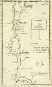
Horsley Wall map extract

Horsley Wall map extract

Generalised maps of varying quality proliferated in the 16th century but a significant development came with the publication of John Horsley’s Britannia Romana in 1732, which included a map of the Wall made for him by George Mark. This was the first serious attempt at a survey of the Wall. Soon after, the decision to build the Military Road from Newcastle to Carlisle led to a survey of the proposed line by Campbell and Debbeig in 1749. The two known surviving copies include a detailed record of the remains of the Wall, including what may be the first attempt at an elevation drawing of the curtain wall (from a section west of Harlow Hill which, ironically, would soon be destroyed by the construction of the road itself). Both Horsley’s text and the Military Road survey appear to have ‘informed’ the derivative publication by John Warburton of his Vallum Romanum in 1753.

MacLauchlan's survey of Birdoswald

MacLauchlan’s survey of Birdoswald

In the 19th century, the Duke of Northumberland commissioned Henry MacLauchlan (a former member of the Ordnance Survey who was an advocate of shading over contours to depict topography) to prepare a detailed survey of the Roman Wall, which included several site plans (like that of Birdoswald, seen here). MacLauchlan wrote his Memoir (published in 1865) to accompany the overall plan of the Wall and it was sufficiently highly thought of to be used in several editions of Collingwood Bruce’s Handbook to illustrate the course of the monument and can still be purchased from various outlets as an attractive historic print. Its publication more or less coincided with that of the Ordnance Survey’s First Edition series of one-inch and six-inch sheets.

OS Hadrian's Wall map

OS Hadrian’s Wall map: search Ebay to find used copies

Inexorably, the Survey’s involvement with archaeology led to the production in 1964 of its two-inch Hadrian’s Wall historical map (a copy of which is still on the wall of Housesteads museum). Distinguishing between visible and presumed (or known and not visible) elements superimposed on a clear map base, it also incorporated a simple but effective fold system which made (and still makes) it easy to use in the field. It was updated in 1972 but, in 1989, the Survey produced a completely new map of the Wall that was truly abysmal in a rich and bemusing variety of ways, not least the use of their 1:50,000 map base (photographically enlarged to 1:25,000 for the Central Sector) and a confusing series of conventions. Murophiliacs clung on to their precious copies of the older map. Screeds of irrelevant text and diagrams only served to obfuscate its purpose as a map, rather than an essay-cum-gazetteer.

51851The use of aerial photography for mapping became widespread in the latter part of the 20th century and this resource was exploited by English Heritage’s National Mapping Programme to revise the coverage of the Wall area. This information was ultimately fed into English Heritage’s brand-spanking-new 1:25,000 Archaeological Map of Hadrian’s Wall, first published in 2010. Not without its problems (its map base is greyed out in favour of graduated tones to indicate height – thereby, presumably unwittingly, supporting MacLauchlan’s view – and the awkward folds of the double-sided sheet render it much more cumbersome in the field than the old OS map), it has nevertheless provided up-to-date information and extended coverage down the Cumbrian Coast.

At the same time, the availability of rectified satellite and vertical aerial photography through virtual globes such as Google Earth meant that neogeographical techniques could now be applied to Hadrian’s Wall, and that was the origin of Per Lineam Valli which first went live online in 2007 and is about to see a major upgrade. The combination of separate layers for each of the major components with the ability to hyperlink each site to online resources such as the National Monument Record’s Pastscape database and the UK government’s MAGIC map base, together with plans and photographs of the monument. The rapid development of GPS-enabled smartphones has made it possible to use the Per Lineam Valli file in the field (as a layer in Google Maps Mobile) to tap into these resources.

What is next? The use of lidar is already making aerial survey topographically more accurate and airborne ground penetrating radar, currently being developed for landmine detection, may soon be added to the armoury of the archaeologist. On the ground, you can expect the nascent technology of augmented reality to enable you to see 3D reconstructions of the Wall in situ and in real time using a mobile phone or tablet, allowing a variety of interpretations of, say, a turret to be presented. ‘Paper’ maps (the English Heritage map is already made of waterproof polyethylene, not dead trees) may be supplemented (if not replaced) by flexible e-ink displays that will draw detailed mapping and data access ever closer.
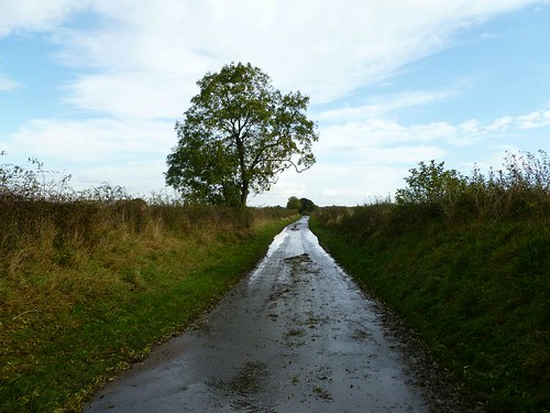
Wall Mile 69

Wall Mile 69 [HB 348]

The curtain wall finally quits the riverside (but keeps to the high ground) at the northern end of Kirkandrews village, its line being reflected in property boundaries through the village.

The Wall at Kirkandrews

The Wall at Kirkandrews from the air, looking south

The Trail leaves it and drops down to the floodplain of the Eden, at the base of the scarp, and then after a while climbs back up again, rejoining the line of the curtain wall near the eastern end of the village. We are led along the line of the Wall, trying to ignore an architectural eyesore off to our right (how did that get planning permission in a World Heritage Site?) and then down to the delightfully named Sourmilk Bridge, so good they just had to name a milecastle after it. Crossing the bridge, which is just east of one possible site for Milecastle 69, the path follows a 50° change in course from south-east to slightly north of east and ascends to another possible site for the milecastle.

Altar recording military action

Altar recording military action ‘across the Wall’.

Milecastle 69 (Sourmilk Bridge) [HB 348; haiku]

You will have gathered that the site of Milecastle 69 has not been located as yet, despite geophysical surveys in two possible locations (one in 1998 next to the bridge and the other in 2000 at the top of the next rise). A trial trench in 2000 also failed to find it.

A rather interesting inscription comes from nearby, recording successful military action under the magnificently named legate of legio VI Victrix, L. Iunius Victorinus Flavius Caelianus. It probably dates to the latter part of the 2nd century AD, after the return from the Antonine Wall, and significantly includes the phrase ‘trans Vallum’ – ‘across the Wall’. We shall return to what the Romans called the Wall in a while.

Seditio2ad