Wall Mile 70 [HB 348–9]
The use of the line of the ditch by roads and tracks is a theme that will recur a number of times as we progress. The lane continues and, at a junction with a track to our left, lies the location of Turret 70b. You will doubtless be unsurprised to learn that there is nothing to see. The lane ultimately leads to the village of Beaumont and when we reach a three-way fork in the road (NY 346 593), we need to take the left-hand branch: it is not clearly signposted.

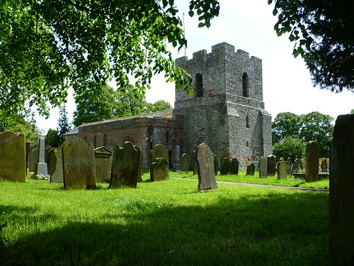
Beaumont church near location of Turret 70a
Emerging onto the road, we turn right into the heart of the village, noting the location of the church, which is where Turret 70a is thought to lie. The Trail takes the walker off the line of the Wall now and down to the riverside, whilst the frontier itself cuts across the village and the fields beyond, also making for the Eden and eventually the two join up again, although the precipitous nature of the river terrace here means the ditch is deemed unnecessary and stops at Monkhill Beck for a while. We have already seen the efficacy of the ditch being enhanced by the careful exploitation of terrain, but this is the first, but not the only, time that we can see the Wall course using a natural feature to render the ditch superfluous.
Milecastle 70 (Braelees) [HB 348; haiku]
The position of Milecastle 70 (Braelees) is perched on the edge of the cliff above the Eden and, since it has never been examined (or even found), it is not known whether the builders bothered with a north gate for it.


You must be logged in to post a comment.