Wall Mile 26 [HB 188–91]
Our return to the main road requires us to cross the road and then head up the hill towards the crossroads. The Wall, meanwhile, is inaccessible, still heading across the fields towards Brunton Turret, where we next encounter it. Turn right at the crossroads onto the A6079 and look out for the lay-by on the left-hand side of the road and the stile just after it. This takes us into a field and a short walk up to a consolidated stretch of the Wall and Turret 26b.
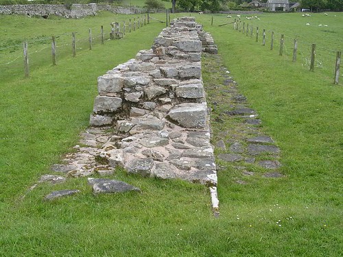
Turret 26b (Brunton)

Turret 26b with its wing wall
In some respects, this is just another turret. However, it lies at an important junction, between the narrow wall (on its east side, marked by a short yet familiar wing wall) and by the narrow wall to the west, marked by the turret being bonded seamlessly with it. It is clear, then, that the decision to change from the broad to narrow gauge occurred at around the time the curtain wall gang reached this turret from the west (or did they start from here and work westwards, the next gang starting further east and heading towards Brunton?). Hadrian’s Wall is all about change, modification, and adaptation, and here this flexibility is plain to see. The threshold to the doorway reveals slots for monolithic stone jambs and a pivot hole (with a respectable channel) on the eastern side.

Brunton Turret
Now we must confront the fact that we cannot follow the wall through the grounds of Brunton Hall but must make a huge detour to get back onto its course. We exit the field the same way we came in, cross over the road and turn left, heading south along the road towards the appropriately named village of Wall (although we are going to turn off before we reach it). Soon, our journey along this narrow pavement, far too close to speeding traffic, comes to an end at a short rise when we see a turning over to the left, opposite another lay-by. Crossing over, we proceed down this lane, taking care to look out for traffic using it as a rat-run between the Military Road and the road we have just left. Finally, after a long (but not overly unpleasant) trudge along tarmac (the by-now-familiar indication of recalcitrant landowners), we near the end of the road and a path leads off through the trees to our right, bringing us gratefully back onto the line of the Wall. The path winds between the berm and ditch, the course of the curtain wall lying on the southern edge of the plantation we are passing through.

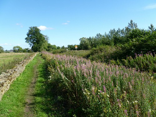
The line of the curtain wall heading up to Planetrees
Suddenly we emerge into the open again and find a slope awaiting us, with the ditch becoming apparent and, to our right, first a natural gulley and then the earthworks of the Vallum. We carry on up the hill and ultimately, after crossing a drystone wall via a ladder stile and are presented with the stretch of wall at Planetrees.
Planetrees curtain wall
The curtain wall at Planetrees
This short stretch of curtain wall has achieved by virtue of the fact that it owes its continued existence to intervention by William Hutton whilst he was walking the Roman Wall. Arriving here, he found the local tenant in the process of demolishing it. Ironically, the Military Road had preserved it by veering off its course some way to the east in order to descend into the valley of the north Tyne by a less bold route than that adopted by the Wall.

Junction of the broad and narrow gauge walls
This is the eastern end of the stretch of narrow wall we saw at the bottom of the hill, meeting Brunton Turret. The junction here at Planetrees is equally abrupt, broad wall on a broad foundation suddenly changing to narrow wall on that same broad foundation. The gang building the foundation had included a drain running the full width which protrudes incongruously, a memorial to changed plans.
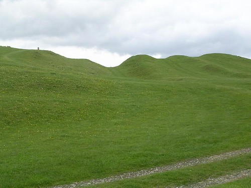
Milecastle 26 (Planetrees) [HB 188; haiku]

The site of Milecastle 26
We now continue up the field to the point where we need to cross the Military Road again, with all the care due that is implied, to take us to the north of the road. Here, in this field, next to a gate opposite Planetrees Farm, we arrive at the site of Milecastle 26.
Milecastle 26 (Planetrees) was a long-axis example, excavated in 1930. Nothing remains to be seen now.


You must be logged in to post a comment.