Driving Hadrian’s Wall: the Main Car Parks V (Housesteads)

Housesteads (NNP)

Coordinates: N55.009974, W2.322925 Facilities: toilets, picnic spot, refreshments, visitor centre

Housesteads car park is not only well-signposted on the B6318 (the Military Road) travelling from both the east and west, it is right next to the road, although – situated on a bend and at a slight crest – it can appear suddenly. This is another of the Northumberland National Park car parks for which a season ticket can be acquired; an ordinary ticket bought from the machine here can be used on that day at any of the other National Park car parks along the Wall.

Advice

Always be aware of the possibility of thieves operating in the car park. Follow signs for the Hadrian’s Wall Path to access sites to either side of Housesteads. Stout footwear is advisable. Access to the fort and museum is by a paved path.

Housesteads car parkZone 3 (1km)

1. Housesteads museum and fort

2. Curtain wall Wall Mile 36

3. Knag Burn gateway

Zone 4 (2km)

4. Milecastle 37

5. Cuddy’s Crags classic viewpoint

6. Curtain wall Rapishaw Gap

7. Milecastle 36

8. Busy Gap ditch

Zone 5 (3km)

9. Curtain wall on Sewingshields Crags

10. Sewingshields Turret

11. Sewingshields Milecastle

Driving Hadrian’s Wall: the Main Car Parks IV (Steel Rigg)

Steel Rigg (NNP)

Coordinates: N55.002899, W2.391337 Facilities: picnic spot

Steel Rigg is well-signposted on the B6318 (the Military Road) travelling from both the east and west (the turning is opposite the turning for Vindolanda). This is another of the Northumberland National Park car parks for which a season ticket can be acquired; an ordinary ticket bought from the machine here can be used on that day at any of the other National Park car parks along the Wall.

Advice

Always be aware of the possibility of thieves operating in the car park. Follow signs for the Hadrian’s Wall Path to access sites to either side of Steel Rigg. Stout footwear is advisable. South and east of the car park is one of the finest stretches of ‘Claytonised’ curtain wall; please do not climb on it. In the event of very windy weather, or if you suffer from vertigo, the Military Way (4) makes an acceptable alternative route for reaching the points of interest.

Steel Rigg car parkZone 2 (500m)

1. Curtain wall and ditch Wall Mile 39

2. Peel Gap turret

3. Curtain wall Peel Crags

4. Military Way

Zone 3 (1km)

5. Milecastle 40

Zone 4 (2km)

6. Milecastle 39

7. Mons Fabricius

8. Sycamore Gap

9. Curtain wall Sycamore Gap

Driving Hadrian’s Wall: the Main Car Parks III (Cawfields Quarry)

Cawfields Quarry (NNP)

Coordinates: N54.993100, W2.450701 Facilities: toilets, picnic spot

Cawfields Quarry is well-signposted on the B6318 (the Military Road) travelling from both the east and west (the turning is opposite the Milecastle Inn). This is another of the Northumberland National Park car parks for which a season ticket can be acquired; an ordinary ticket bought from the machine here can be used on that day at any of the other National Park car parks along the Wall.

Advice

Always be aware of the possibility of thieves operating in the car park. Follow signs for the Hadrian’s Wall Path to access sites to either side of Cawfields Quarry. Stout footwear is advisable.

Cawfields Quarry car park planZone 1 (100m)

1. Wall ditch Wall Mile 42

Zone 2 (500m)

2. Milecastle 42

3. Vallum

4. Military Way

5. Curtain wall Wall Mile 41 (either way)

Zone 3 (1km)

6. Curtain Wall at Thorny Doors

7. Great Chesters fort

Zone 4 (2km)

8. Turret 41a

9. Milecastle 41

10. Milestone

Driving Hadrian’s Wall: the Main Car Parks II (Walltown Quarry)

Walltown Quarry (NNP)

Coordinates: N54.986800, W2.520391 Facilities: toilets, refreshments, picnic spot

Walltown Quarry (and the neighbouring Roman Army Museum) is well-signposted on the B6318 (the Military Road) travelling from both the east and west (the turning is 800m east of Greenhead). This is one of the Northumberland National Park car parks for which a season ticket can be acquired, but an ordinary ticket bought from the machine here can be used on that day at any of the National Park car parks along the Wall. Note that the sites east of Walltown Quarry can also be accessed from the free car park at Walltown Crags.

Advice

Always be aware of the possibility of thieves operating in the car park. Follow signs for the Hadrian’s Wall Path to access sites to either side of Walltown Quarry. Stout footwear is advisable.

Walltown Quarry car parkZone 1 (100m)

1. Wall ditch Wall Mile 45

Zone 3 (1km)

2. Curtain wall Wall Mile 45

3. Turret 45a

Zone 4 (2km)

4. Curtain wall Wall Mile 45

5. Milecastle 45

6. Turret 44b


Driving Hadrian’s Wall: the Main Car Parks I (Birdoswald)

Birdoswald (EH)

Coordinates: N54.991552, W2.600871 Facilities: none

Birdoswald is well-signposted on the A69 travelling from both the east and west. The English Heritage car park immediately east of Birdoswald fort is primarily designed for visitors to that monument. That much is clear from the fact that you can get the cost of your parking (£4 in 2015) reimbursed when you visit the fort. However, you can also use it for exploring the surrounding bits of Hadrian’s Wall.

Advice

Do not park in and obstruct the bus turning area (you should hear what coach drivers call the idiots who do this!) and do not leave valuables in your car. There are posters warning about thieves for a good reason (last time I was there some cars were broken into only a couple of days later). Follow signs for the Hadrian’s Wall Path to access sites to either side of Birdoswald. Stout footwear is advisable.

Map of the area around Birdoswald car park

Zone 1 (100m)

1. Birdoswald fort

2. Curtain wall (Wall Mile 49) east of Birdoswald

Zone 2 (500m)

3. Milecastle 49

4. Curtain wall (Wall Mile 49) west of Birdoswald

5. Turret 49b

Zone 3 (1km)

6. Willowford Bridge Abutment

7. Turf wall (Wall Mile 49)

Wall Mile 54

Wall Mile 54 [HB 326–8]

Continuing downhill, we cross a small burn and a lane (which leads down to Lanercost) and then we soon encounter our last tangible fragments of curtain wall core embedded in white mortar. Visible to our right, it is restrained within a barbed-wire fence (the facing stones have all been robbed away, probably to build Lanercost Priory). At this point, we are near the eastern limit of the Intermediate Gauge wall, built after the retreat from the Antonine Wall. This bit has never been excavated or consolidated and it is possible that it is the only section of Antonine-period stone wall that can be seen on the line of the Turf Wall. Let’s hope that something can one day be done about its rather unloved condition.

Exposed, mortared wall core

Exposed, mortared wall core

We start to climb the hill and, before long, to our left and slightly behind us, the priory is visible in the distance, situated on the flood plain of the Irthing. As soon as we see it emerge from the trees, we are going to stop. Unsurprisingly, as has just been hinted, large amounts of Hadrian’s Wall (especially those now-red sandstone facing stones) were incorporated into the fabric of the priory, a fact betrayed by the inclusion of inscribed building stones within it.

Facing stones from the Wall reused at Lanercost Priory

Facing stones (with inscription) from the Wall, reused at Lanercost Priory

Why did we stop at this very precisely determined location? Well, we are now at a very interesting place: the site of Turret 54a – both of them! As elsewhere west of the River Irthing, the Wall was originally a turf rampart here, the turrets being of stone and later incorporated into the stone curtain wall. However, at some point after construction, Turret 54a collapsed northwards into the ditch and a free-standing replacement had to be provided immediately to the south of it. This meant that, when the time came to replace the turf rampart with a stone curtain wall, the new stone wall had to be aligned to butt against that secondary turret, which in turn meant that the berm between the ditch and that new stone wall was unusually wide.

Wall Mile 54 crossing the Howgill

Wall Mile 54 crossing the Howgill

Carrying on, we pass through a couple of stiles and find ourselves in a lane. Ahead of us, the ditch can be seen heading across the field as a shallow depression, but we are turning right, walking for about 90m, and then turning left when we find the Trail signs again. This is another of those three-sides-of-a-rectangle detours to get around access problems. After trudging along the edge of a field, we turn south again, and then finally westwards, before heading down a slope to cross the Howgill (a stretch that can often be more than a little muddy). Up the other side, through a kissing gate, and we arrive at the site of Milecastle 55.

Milecastle 55 (Low Wall) [HB 328; haiku]

The site of Milecastle 55

The site of Milecastle 55

The position of Milecastle 55 was confirmed by excavation in 1900. An altar to Cocidius (yes, him again) was found in nearby farm buildings in the 18th century, so may well have originated in the milecastle (as others have done).

Wall Mile 53

Wall Mile 53 [HB 323–5]

Opposite the location of Milecastle 53 is the entrance to an enclosure containing one of the highest portions of curtain wall.

Hare Hill curtain wall [HB 323]

The curtain wall core at Hare Hill

The curtain wall core at Hare Hill

At 2.3m in width, this is of course an example of narrow gauge wall. Long famed for being the tallest surviving section of the curtain wall (3m), the north face is in fact a late-19th-century reconstruction, undertaken at the behest of the Earl of Carlisle, although the core stands to its original height. However, all is not as it seems.

The reconstructed facing stones at Hare Hill

The reconstructed facing stones at Hare Hill

The keen-eyed will note that the face is not even aligned on the much-more-modest (and more recently) exposed section immediately to its east and do-it-yourselfers will doubtless tut-tut at this example of careful Victorian laxity. This stretch of curtain wall actually conveys a powerful message about the way in which attitudes to the consolidation of the monument have changed. Whilst replacing facing stones was once thought acceptable, the more recent approach has been to consolidate it as found. If you happen to prefer one over the other, good for you; neither is necessarily right or wrong. Before we depart, locate the centurial building stone on the north face (nine courses down from the top, two stones in from the left), reading ‘< P · P ·’ (centuria primi pili), or ‘the century of the senior centurion (of the legion)’. It (RIB 1958) was found some time before 1894, west of Turret 53a, and built into the reconstructed face of the curtain wall. Remember, with Hadrian’s Wall, all is not as it seems.

Leaving the curtain wall enclosure by means of either of the two gates (although the upper one makes more sense), we turn right up the narrow lane and then through the kissing gate to our left which leads us around the south side of the farm buildings at Hare Hill. We now follow a stretch with the curtain wall as hedgerow with the ditch concealed to the north of it.

As we approach the crest of Craggle Hill, the hedgerow gives way to a modern drystone wall that makes prominent use of the facing stones from its Roman predecessor. The ditch can be clearly seen to the north. We shall soon be leaving the buff sandstone of the central sector and become familiar with the red sandstone of the western sector. This ‘complex unconformity’ is often identified (incorrectly, it seems) with the so-called Red Rock Fault, although this is debated by geologists who doubt its continuation this far north. We can safely leave them to mutter over that and merely note that the bedrock is changing and that this change is manifested in the stone of the Wall itself.

Field wall and ditch on Craggle Hill

Field wall and ditch on Craggle Hill

The line of the Vallum is off to our left, passing through a recently clear-felled area of plantation. We follow the Trail and bound merrily down the slope towards a large, prominent oak tree with a perceptible platform. This is the site of Milecastle 54.

The site of Milecastle 54 from Craggle Hill

The site of Milecastle 54 from Craggle Hill

Milecastle 54 (Randylands) [HB 325–6; haiku]

Excavated in 1933/4, this splendidly named long-axis milecastle was situated on a west-facing slope and was the most westerly reconstructed in stone before the move to the Antonine Wall in the fifth decade of the 2nd century AD. Examination also revealed the Turf Wall period milecastle underneath its stone successor.

Wall Mile 52

Wall Mile 52 [HB 320–2]

After the farm, we hop over the wall by means of a stile and are back in a field south of the road. We now head west along the National Trail next to the field wall that divides us from the road. The Vallum is just to our left but has been almost completely ploughed out. After a while we come to a kissing gate, where we turn right and immediately see Pike Hill signal tower, perched precariously next to the road.

Pike Hill Signal Tower [HB 320–1]

Pike Hill signal tower

Pike Hill signal tower

This square stone tower was set at an angle to the line of the Wall. Positioned on the crest and cut by the same road that overlay the neighbouring turret, only parts of two sides and one corner remain to be inspected. Fortunately, the south-eastern side contains the entrance at its southern end. This additional tower between Milecastle 52 and Turret 52a has been interpreted as a pre-Wall signal tower, probably associated with the Stanegate ‘frontier’, which was later incorporated into the Wall, due to its advantageous position for signalling. In this it closely matches Turret 45a on Walltown Crags and the two sites may well have been intervisible in good weather (the two are just under 10km apart). Note the door (and the fact that most of the tower was removed by the later road) before we retrace our steps and head down the path in front of us towards a proper turret.

Turret 52a (Banks East) [HB 320–2]

Turret 52a

Turret 52a

Banks East Turret lies just 205m to the west of Pike Hill and was first excavated in 1933. It was, you will be amazed to learn, the first piece of Wall in Cumbria to be placed into the guardianship of the Ministry of Works (in 1934). The road, which used to follow the line of the curtain wall closely, originally ran over the top of it, but has subsequently been moved onto the berm (the ditch is very plain to the north of the road). The curtain wall to either side of the turret is, once again, the narrow gauge form that predates the move to the Antonine Wall and is pierced at ground level by several drains, designed to stop water ponding against it.

The turret itself, being originally constructed free-standing and with the turf wall butted against it, is very clearly of a different build to the curtain wall. The butt joints between wall and turret are obvious and the turret protrudes to the north of the line of the curtain wall. On its north face is a fine plinth course which you will need to fix in your memory for later. Why is the plinth course there? Nobody knows. Perhaps it marked a feature of the Turf Wall itself, such as the top of a vertical front section (although turf ramparts were usually battered inwards so that they were narrower at the top than at the base, the lowest portion was sometimes vertical).

The plinth course on Banks Turret

The plinth course on Banks Turret

The chief distinguishing features of the turret are that it is square with an entrance at ground level (in this case at the eastern end of the southern side) and that it is recessed into the thickness of the curtain wall. A hearth lay against the west wall. As with all archaeological reconstruction, the higher up we look, the less certain we are about details. It is assumed it had entrances on either side at the level of the top of the Turf (and later Stone) Walls, although there are those who do not believe Hadrian’s Wall had a walkway or parapet on top (more of that later). As part of the Turf Wall, the front and back of this stone turret coincided with the front and back of the turf rampart, but when the stone curtain wall was provided, the turret was left to project slightly to the north (turrets to the east, built at the the same time as the curtain wall, did not do this), so some scholars have suggested this means the curtain wall was lined up on those side entrances to the (presumed) walkway. Turrets and towers in the ancient world were generally intended to give a height advantage, so we can be fairly safe in assuming its top was higher than the Wall, although by how much is uncertain; part of the tumbled superstructure lies immediately outside the west wall. Equally, we do not know if it had a flat roof with a parapet and fighting platform or whether it was conventionally roofed. As you can readily see, what we know about turrets is far outweighed by what we have to guess.

After a short stretch squeezed between a fence and the field wall we are thrown brutally back onto the road to march through Banks itself. On our way we can admire a fine example of purpresture (the attempt to acquire public property as private, in this case the verge) in action (or should that be inaction?).

Purpresture in operation

Purpresture in operation

We still have the ditch to our right, but when we fork right down a lane to follow the Trail we cross it and the Wall continues more directly down the hillside. Consideration was once given to consolidating a length of wall east of Milecastle 53, but nothing ever came of this and there is nothing to see. We turn left (watching out for traffic as this road can be busier than the one we have just left) and then right up the driveway towards Hare Hill.

Milecastle 53 (Banks Burn) [HB 322–3; haiku]

Milecastle 53 lay beneath the present house to our left, and was examined in 1932. Largely destroyed, it was an example of a long-axis milecastle. There is, predictably perhaps, nothing to see.

Wall Mile 50

Wall Mile 50 [HB 309–16]

It might justifiably be argued that this is one of the most interesting of the Wall Miles. Not by me, I hasten to add, but I can see why it could be thought to be.

The Turf Wall and ditch (foreground) with the Vallum (beyond)

The Turf Wall and ditch (foreground) with the Vallum (beyond)

The Trail takes us gently downhill, next to the Turf Wall (a low mound north of its ditch) and then across a couple fields, keeping the earthwork to our left. The Vallum is immediately behind the Turf Wall and that proximity may have been one reason for moving the Stone Wall slightly to the north (the Vallum is in places perched on the edge of the Irthing gorge so has nowhere else to go). We can clearly see the road, following the line of the Stone Wall, off to our right. At the end of this long straight stretch we exit the field, turn right up a track, and then left and over a small pedestrian bridge.

Turf Wall and ditch

Turf Wall and ditch

The Stone Wall

After leaving the site of Milecastle 50, apart from the ditch to the north of the road and the comforting knowledge that the curtain wall lies beneath the road, there is not much to see if we go this way, although it does provide continuing assurance of the way in which the Romans used the terrain to enhance the effect of the Wall. To get back onto the Trail proper, those following the Stone Wall route need to turn left onto the track to Lanerton Farm and then immediately right and over the pedestrian bridge.

Crossing the Turf Wall and its ditch

Crossing the Turf Wall and its ditch

After that bridge, the Trail passes through a line of trees and climbs the slight slope ahead of us, ultimately crossing the Turf Wall ditch just before we reach Milecastle 50, where the Turf and Stone Walls reunite.

Milecastle 51 (Wall Bowers) [HB 316; haiku]

Milecastle 51

Milecastle 51

Located at the north end of the field, next to a field gate, Milecastle 51 is rather interesting, since (like Milecastle 29) it is one of the few to display traces of a ditch (on its eastern side). It was excavated in 1927, 1934, and 1936 and the robber trenches for its east and west walls are still very clear.

Wall Mile 49

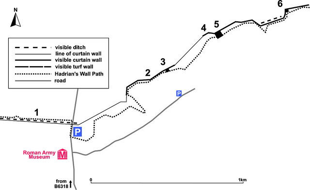
Wall Mile 49 [HB 291–309]

Just after we leave Milecastle 49, the curtain wall changes alignment slightly and this is the point where the Turf and Stone Walls diverge. The Turf Wall ran in a straight line from here towards the main east–west street (via principalis) of Birdoswald fort (it pre-dated the fort, as we shall see).

The curtain wall east of Birdoswald

The curtain wall east of Birdoswald

The fine stretch of curtain wall east of Birdoswald continues as far as just before the east wall of the fort. When consolidated by the Ministry of Works masons, this section produced numerous building inscriptions, many of which are now in Tullie House Museum in Carlisle, although some have been left in situ. It also revealed two further phallic symbols on the south face; if the same density found in this Wall Mile were repeated for the whole of Hadrian’s Wall, there might originally have been around 350 along the Wall. The first of the Wall Mile 49 phallic symbols occurs at 163m west of the kissing gate out of Milecastle 49. Building inscriptions can be found at 218m (RIB 3425), 227m (RIB 3426), 248m (RIB 3427), and 322m (RIB 3434). The last is preserved in the top surviving course.

The first phallic symbol in Wall Mile 49

The first phallic symbol in Wall Mile 49

The second phallic symbol occurs at 347m, 10m east of the western end of the field wall parallel to the curtain wall, and just after a culvert through the wall. The culvert is interesting, since it is additional to the normal ground-level drains that can be seen in this Wall Mile and whilst it may have been designed to cope with a spring which is no longer evident (which seems unlikely), it may have served to debouch a sewer from an as-yet-unidentified extramural building into the ditch to the north.

After passing through the kissing gate at the end of the field, we can afford to take the time to walk back a little way down the path towards the car park and admire the north face of the length of wall we have just walked past, weirdly sculpted right back into its core by the combination of its former role as a field boundary and the action of some large tree roots that had to be removed when it was consolidated in the 1950s. As you look eastwards, the ditch is clearly visible in front of the wall. We may now retrace our steps and make for the fort. To avoid the road, the Trail briefly weaves through a small plantation and, as it passes over the eastern fort defences, we may look down to our left and see a circular post-medieval corn-drying kiln set into the Roman wall. The entrance to the fort is now signposted ahead of us.

Birdoswald fort (BANNA) [HB 294–307]

A word on pronunciation: you can ensure polite local amusement by calling the fort Birdo-swald but the cognoscenti all defer to Bird-oswald. With that out of the way, it’s time for a little castrametation.

The Turf Wall originally strode across the site of the fort unhindered. When the decision to add forts to the Wall design was made, it is fairly certain (although not yet proven) that the first here was constructed in turf and timber, flattening the Turf Wall rampart and Turret 49a TW, and filling in the ditch. That first fort seems to have been slightly smaller than the stone one we see today, for when the Vallum was built, it avoided the southern end of it with a slight detour, although not enough to avoid successfully the stone fort defences. So much for the early fort, which we can’t even see, but it is time for a brief tour of the stone one, which is admirably apparent.

The Trail guides us up the western side, amongst some trees, and along the northern defences of the fort, on the road to the English Heritage entrance. After entering and paying, another door takes us into a courtyard. Public conveniences are to the right, the museum to the left. Entering the museum at ground level there is an audiovisual presentation in a room to the right whilst the stairs take us up to the main gallery, through a reconstruction of a turret. There are various items of interest here, but at the far end of the gallery, just before the exit, note the ‘stuffed archaeologist’, a passable likeness of Tony Wilmott, director of excavations here since the 1980s and even rumoured to be wearing one of his old wax jackets.

Exiting the museum, we make for the path to the right of the youth hostel and this leads to the west gate (porta principalis sinistra) of the fort. By now you should be an old hand at Roman forts: all you need to remember is that they are all the same; except they’re not. Let’s just compromise on ‘they’re all similar’.

A causeway pierced by a drain crosses the fort ditch, bringing a road through the one surviving gate portal; the other, to the right of it, is blocked. The blocking of twin-portalled gateways will become a theme for our journey along the Wall. To the right of the blocked gateway is some very fine masonry, about the only true example of ashlar masonry you will see on this trip. Most of the stonework on Hadrian’s Wall is what masons term ‘squared rubble’ so this piece is rather special and it has been suggested that it may originally have been part of some sort of commemorative monument constructed here. Crossing the causeway, we can see that the guardroom to the left has been given underfloor heating in its later years, whilst the blocked portal to our right has also been used as a room. When excavated, the Turf Wall ditch was found here, carefully backfilled with rubble.

The ashlar walling after excavation

The ashlar walling after excavation

Once inside the fort, it is important to understand that, for display purposes, the later years of the fort’s occupation have been emphasised. This is not unreasonable, for Birdoswald is especially interesting, in that it demonstrates continuity of occupation from the Roman period, through the early medieval and medieval fortified settlements, right up to modern times and its earlier life as a working farm and subsequent career as a visitor attraction.

At Birdoswald, the two granaries – which are on the right, to the south of the via principalis – were found to have been demolished and overlain by a large timber hall in the post-Roman period and the positions of its main uprights are marked by post stubs. The granaries (horrea) themselves are of a type seen throughout the Roman empire: buttressed outer walls, elevated floors (raised above ground level on dwarf walls or short columns), and loading platforms at one (or even both) ends. The headquarters building (principia) and commanding officer’s house (praetorium) have not been fully excavated and are visible only as (in the words of one former chairman of English Heritage) humps and bumps in the ground. Having admired the granaries, we may now pass through one of the pair of modern gates and turn right, heading for the south gateway.

The post-Roman timber hall on the granary

The post-Roman timber hall on the granary

Both portals of the southern gateway are open, although when originally excavated in 1851 the eastern was found to be blocked and converted into a room. Examination of the portals shows that the pairs of door leaves originally opened inwards and were stopped against a threshold over which wheeled traffic had to bump, a bit like ‘sleeping policemen’, the wheels often wearing ruts in the raised part of the threshold. Roman gates were also not hinged, but rather pivoted, which made them much stronger: whilst a hinge would have had to be nailed to a wooden gate leaf, pivots were integral to its fabric. These pivots were then inserted into socket stones, one at the top and one at the bottom, the lower of the two usually having a channel to enable the pivot to be slid into place. The pivot was fixed by means of an iron ring placed around it which was then cemented to the pivot stone by means of molten lead. We shall see such pivot stones several times on our journey (look on either side of the portals now), but when we get to Benwell we will actually see one of these iron rings still in situ.

The south gate

The south gate

Passing out of the southern gateway we now find ourselves standing on a promontory above the gorge of the River Irthing. When excavated, a Roman encampment was found, complete with preserved fragments of wood and leather (it was one of the first sites where pieces of Roman tent leather were identified), and it has been suggested that it may have belonged to troops building the Turf Wall. The Vallum swerved around the south end of the fort and a causeway with a gate was discovered during the excavations: there is nothing to see now but, as just hinted, we will be inspecting an example at Benwell, later in our journey.

Returning to the fort defences, we take the path to the right and pass around the south-east corner of the fort (rounded, as they all are on the Wall). As we head north along the eastern wall, ahead of us is a section of tumbled curtain wall, frozen in the act of tumbling outwards. Excavation showed that this was in fact a reconstruction of a previously fallen length; the botched reconstruction of failed structures is by now a familiar theme on Hadrian’s Wall. Beyond the tumbled length of wall, take a close look at the upstanding section to the north of it, particularly the coursing of the stones. It is clear how the construction of the wall was split into stints, a feature that is known from other Roman sites such as the ‘Saxon Shore’ fort at Pevensey, and it is likely that each stint was the responsibility of one work gang.

Moving on to the east gate, we can see that the northernmost jamb survives to the height of the springer for its arch. Again, excavation in 1852 revealed that the north portal was blocked. So why build all those twin-portalled gates only to block one gate on each? We don’t know, but it may be that use showed that only one was needed or desirable.

The east gate

The east gate

Time to head back to the exit and be on our way once more. Shopportunities await the acquisitional in the English Heritage retail outlet on the way out, but remember: what you buy you are still going to have to carry.

We turn left out of the fort and walk to the rounded fort corner, admiring its northern defences as we go and stopping at that corner to look down and see the fragmentary foundations of the curtain wall, later removed by the fort’s ditch. The wall butted against the fort as the stone fort pre-dates the construction of the stone wall. We now have a choice between following the Stone Wall or the Turf Wall. Don’t worry if you change your mind as we can swap over in a while. If opting for the Turf Wall, follow the Trail signs through the plantation; if the Stone Wall, then follow the very obvious consolidated stone curtain wall (safer on the south side, but the north side is possible with care; traffic tends not to speed along here).

This is the last substantial length of curtain wall to be encountered when walking from east to west (although there will be some shorter bits), but it is rather unusual compared to much of the rest of the Stone Wall. This is because, as we have just realised, it is not built on the line of the Turf Wall, which runs up to 200m to the south (at the Milecastles 50), and was constructed shortly before Hadrian’s Wall was abandoned in favour of the Antonine Wall in the AD 140s, being built to the narrow, rather than intermediate, gauge. At the western end, this stretch of curtain wall has been damaged on its northern face by the road but, by the time it reaches Turret 49b, its full width is intact.

The curtain wall W of Birdoswald

The curtain wall W of Birdoswald

If we decide to follow the curtain wall, we may note in passing a number of drains through the wall at ground level and a heavily damaged stretch with a disguised stile incorporated, so the wall can be crossed if wished to see the remnants of the ditch to the north of the road. There is another damaged section further on where a section has been removed many years ago around the entrance to the field. Ultimately we reach Turret 49b SW (there was no 49a SW as the fort occupied its location).

Turret 49b SW (Birdoswald) [HB 313–14]

Turret 47b SW

Turret 47b SW

For those who have opted to follow the Turf Wall, this consolidated section of stone wall and its turret can still be reached from the Trail by climbing over the stile at Turret 49b. The turret, the entrance to which is on the right, is bonded to the curtain wall – a detail we need to bear in mind for comparison with turrets yet to come – and was never free-standing. Since it is on the Narrow Wall, it was constructed after those to the east of the Irthing and before the move to the Antonine Wall. It was first excavated in 1911 and consolidated for display in 1953–5. Some 12m west of the turret, on the top course of the south face of the curtain wall, the last of the three Wall Mile 49 phallic symbols can be seen.

The Stone Wall

Apart from the ditch to the north of the road and the comforting knowledge that the curtain wall lies beneath the road, there is not much to see if we go this way, although it does provide continuing assurance of the way in which the Romans used the terrain to enhance the effect of the Wall. Climbing up a gentle rise we arrive at a high point which marks the location of Milecastle 50 SW.

The curtain wall W of Turret 49b

The curtain wall W of Turret 49b

Milecastle 50 SW (High House) [HB 314–15; haiku]

This long-axis stone milecastle was excavated in 1911 and produced three building inscriptions, two of them by legio VI Victrix and one by legio II Augusta. The fortlet platform can just about be discerned by peeking over the southern roadside wall at the right point.

The Turf Wall

Those opting for the Turf Wall route will find themselves departing the stone wall and heading south, climbing up the field. From there onwards, turning west, we are walking along the northern lip of the Turf Wall ditch, with the mound of the rampart itself to the south of it and beyond that the earthworks of the Vallum, crammed into the limited space between the Turf Wall and the edge of the scarp north of the Irthing. It was along this stretch that the existence of the Turf Wall was first proved conclusively by Francis Haverfield and his co-workers when they cut a trench across it (they were less than impressed by his excavation methodology, it seems) and that section is reopened and cleaned up every ten years when the Pilgrimage wanders this way.

After a while, just before we start to descend, we reach the site of Milecastle 50 TW and this affords a good opportunity to look ahead at the separated Walls west of us.

Milecastle 50 TW (High House) [HB 309–12; haiku]

To say that there is not much to see of Milecastle 50 TW is probably something of an understatement but no less true for all that. It has the distinction of being the only Turf Wall milecastle without a Stone Wall successor on top of it. Excavated in 1934, it was found to have an undug causeway across the ditch, a rampart of turf and gateways of timber (which, it is suggested, had towers, since there were thought to be too many timbers just for revetting the gateway; believe it or not, this is the main argument for stone milecastles having towers). The Vallum ditch swerved south to avoid the milecastle, but more interestingly the excavations found a timber inscription, restored as recording its construction under A. Platorius Nepos, and thus confirming it to be Hadrianic. It is customary to think of Roman inscriptions as being carved in stone, but (as we saw with the milestone just after Great Chesters) they could be painted on stone or carved or painted) on wood. These are amongst the Rumsfeldian ‘known unknowns’ of Roman archaeology.