Introduction
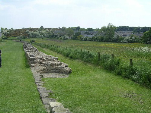
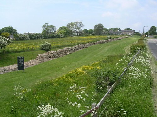
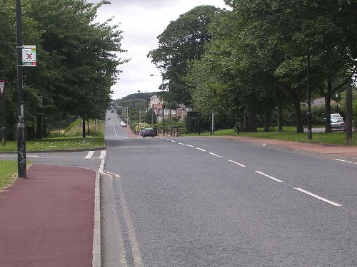
This section covers Wall Miles 6 to 13, nearly all of which (i.e. WM8–13) is now beneath the Military Road. Many are unprovenanced, usually having been rebuilt into another structure, but some were recovered from the Wall during the construction of the road in 1751. Unfortunately, the locations of these stones were not accurately recorded.
Inventory
RIB 1353: VIAT (‘…]VIAT[…’). Found 1807 built into a house near MC7. Now lost. Source: RIB I p.446
 RIB 1354: c(enturia) Here/nniani (‘The century of Herennianus (built this)’). Centurial stone found before 1732 beside the road at Denton. Now lost. Source: RIB I p.446
RIB 1355: N (‘N’). Building stone found before 1789. Now lost. Source: RIB I p.446
RIB 1356: c(enturia) Iuli / Rufi (‘The century of Iulius Rufus (built this)’). Centurial stone found 1804 near Denton Hall. Source: RIB I p.447
RIB 1357: c(enturia) Iuli / Rufi (‘The century of Iulius Rufus (built this)’). Centurial stone found 1804 near Denton Hall. Source: RIB I p.447
 RIB 1358: leg(ionis) II Aug(ustae) / coh(ors) I / fec(it) (‘Second Legion First Cohort built this’). Building stone found 1869 near Denton Hall. Source: RIB I p.447
RIB 1359: l(egionis) II Aug(ustae) / c(o)ho(rs) VIII / fec(it) (‘Second Legion Eighth Cohort made this’). Building stone found 1716 in East Denton. Source: RIB I p.447
 RIB 1360: leg(ionis) / II Aug(ustae) co/h(ors) VIII (‘Second Legion Eighth Cohort (built this)’). Building stone found 1725 at Denton Wood House. Source: RIB I p.448
RIB 1361: c(enturia) Tu[lli] (‘The century of Tullius (built this)’). Centurial stone found 1936 on north mound of Vallum. Source: RIB I p.448
RIB 1362: c(enturia) Val(eri) Fl(avi) (‘Century of Valerius Flavus (built this)’). Centurial stone found 1934 on north mound of Vallum. Source: RIB I p.448
RIB 1363: c(enturia) Val(eri) Fl(avi) (‘Century of Valerius Flavus (built this)’). Centurial stone found 1934 on north mound of Vallum. Source: RIB I p.448
RIB 1364: c(enturia) Pro(culi) (‘Century of Proculus (built this)’). Centurial stone found 1934 on north mound of Vallum. Source: RIB I p.448
RIB 1365: c(oh(ortis) I / Dacor(um) / c(enturia) Ael(i) Dida(e) (‘First Cohort of Dacians the century of Aelius Dida (built this)’). Centurial stone found 1936 on north mound of Vallum. Source: RIB I p.449
 RIB 1366: Iov/i O(ptimo) M(aximo) / [… (‘For Jupiter Best and Greatest…’). Altar found 1822 on the Wall west of Denton Hall. Source: RIB I p.448
RIB 1367: c(enturia) Atisi (‘The century of Atisius (built this)’). Centurial stone found 1953. Source: RIB I p.448
RIB 1368: c(enturia) Avi/di Rufi (‘The century of Avidius Rufus (built this)’). Centurial stone found 1904 in main road west of lane to Newburn. Source: RIB I p.448
RIB 1369: c(enturia)] / Iuli Pri[…] (‘century of Iulius Primus’). Centurial stone found before 1851 in West Denton. Source: RIB I p.449
RIB 1370: VIII (‘8’). Building stone found 1929 in Milecastle 9. Source: RIB I p.450
RIB 1371: VIIII (‘9’). Building stone found 1929 in Milecastle 9. Source: RIB I p.450
RIB 1372: X (’10’). Building stone found 1929 in Milecastle 9. Source: RIB I p.450
 RIB 1373: c(enturia) p(rimi) p(ili) (‘century of the first centurion (built this)’). Centurial stone found 1794 in a stable in Walbottle. Source: RIB I p.450
 RIB 1374: c(enturia) Iuli Pro/culi (‘century of Iulius Proculus (built this)’). Centurial stone found 1906 200 yds W of Engine Inn. Source: RIB I p.450
RIB 1375: coh(ortis) V[… / c(enturia) Iuli Iuv(enalis?) (‘The fifth(/sixth/seventh) cohort, the century of Iulius Iuvenalis’). Centurial stone found 1789 near Walbottle. Source: RIB I pp.450-1
 RIB 1376: c(enturia) Pere/grini (‘century of Peregrinus’). Centurial stone found 1794 slightly east of Walbottle on south mound of Vallum. Source: RIB I p.451
RIB 1377: c(enturia) Muci. / .EN (‘the century of Mucius … (built this)’). Centurial stone found 1732 in a cow shed in Walbottle. Source: RIB I p.451
 RIB 1378: F]elix… (‘Felix…’). Building stone found 1857 at Walbottle. Source: RIB I p.451
RIB 1379: a) I b) III c) V d) VII[ e) VIII f) IX (‘a) 1 b) 3 c) 5 d) 7(or 8/9) e) 8 f) 9’). Building stones found 1732 in field walls near Walbottle. Source: RIB I p.451
 RIB 1380: c(enturia) Car[… (‘The century of Car[…’). Centurial stone found in 1864 at Milecastle 10. Source: RIB I p.451
RIB 1381: V (‘5’). Building stone found before 1732 in Throckley. Source: RIB I p.452
RIB 1382: X (’10’). Building stone found before 1732 in Throckley. Source: RIB I p.452
RIB 1383: C (‘C’ or ‘100’). Building stone found 1926 at Great Hill, near Heddon. Source: RIB I p.452
RIB 1384: R (‘R’). Building stone found 1926 at Great Hill, near Heddon. Source: RIB I p.452
RIB 1385: leg(ionis) XX / V(aleriae) V(ictricis) / coh(ors) IV (‘Twentieth Legion Valeria Victrix (built this)’). Building stone found 1807 in the vicarage at Heddon and now lost. Source: RIB I p.452
RIB 1386: c(enturia) Iul(i) / Ruf(i) (‘The century of Iulius Rufus’). Centurial stone found 1807 in the vicarage at Heddon and now lost. This centurion is also recorded in RIB 1356 & 1357. Source: RIB I p.452
RIB 1387: c(enturia) Fl(avi) As/[… (‘The century of Flavius As[…’). Centurial stone found in church at Heddon-on-the-Wall. Source: RIB I p.453
RIB 1388: leg(ionis) VI [V]i/ct(ricis) P(iae) F(idelis) re[f]/ecit coh(ors) X (‘From the Sixth Legion Victrix Pia Fidelis the tenth cohort rebuilt this’). Building stone found (probably near Heddon-on-the-Wall) during construction of the Military Road in 1751. Now missing. Source: RIB I p.453
RIB 1389: leg(io) VI V(ictrix) P(ia) / F(idelis) ref(ecit) Te/r(tullo) et Sac(erdote) co(n)s(ulibus) / S(…) F(…) (‘The Sixth Legion Victrix Pia Fidelis rebuilt this in the consulship of Tertullus and Sacerdos. S(…) F(…)’). Building stone found (probably near Heddon-on-the-Wall) during construction of the Military Road in 1751. Now missing. The consular date is AD 158. Source: RIB I p.453
RIB 1390: leg(ionis) XX V(aleriae) V(ictricis) / coh(ors) VIII (‘Twentieth Legion Valeria Victrix, eighth cohort’). Building stone found (probably near Heddon-on-the-Wall) during construction of the Military Road in 1751. Now missing. Source: RIB I p.453
RIB 1391: leg(ionis) XX V(aleriae) V(ictricis) / coh(ortis) X [c(enturia)] prin(cipis prioris) (‘From the Twentieth Legion Valeria Victrix, tenth cohort, the century of the princeps prior (built this)’). Centurial stone found 1751 during construction of the Military Road, probably near Heddon. Source: RIB I p.453
RIB 1392: coh(ors) pr/ima DC . L (‘First cohort…’]. Building stone found 1751 during construction of the Military Road, probably near Heddon. Source: RIB I p.454
RIB 1393: XIII (’13’). Building stone found before 1952 at Heddon. Source: RIB I p.454
RIB 1394: Cl(audius) · P[… (‘Claudius…’). Found 1932 at Heddon North Lodge. Source: RIB I p.454
RIB 3286: I (‘1’). Building stone found 1930 in Newburn. Source: RIB III p.287
RIB 3287: II (‘2’). Building stone found 1930 in Newburn. Source: RIB III p.287
RIB 3288: + (‘+’). Building stone found 1930 in Newburn. Source: RIB III p.287
Analysis
There is much that can be made from this disparate bunch of mural chisellings. The bulk of the inscriptions from this section fall into the categories of centurial or building stones, with some quarry marks thrown in for good measure. Amongst the centurial stones, there is also an apparent division between legionary centurions (building the curtain wall itself) and auxiliary centurions working on the Vallum.
The Wall sector between Milecastle 6 (just before Benwell) and around Turret 11b (just before Heddon) has traditionally been assigned to legio II Augusta (Birley 1961, 257), with legio XX Valeria Victrix building Turret 11b to around Milecastle 17, based upon the evidence of the building stones. If correct, this would suggest that Iulius Rufus (RIB 1356-7, 1386), Avidius Rufus (RIB 1368), Iulius Primus (RIB 1369), Iulius Proculus (RIB 1374), and Iulius Iuvenalis (RIB 1375) were all centurions of II Augusta, evidently belonging to cohortes I, VIII, and V[… (the primus pilus mentioned in RIB 1373 was the centurion commanding cohors I in a legion; cf RIB 1358). Two inscriptions referring to reconstruction work by legio VI Victrix (one dated to AD 158) presumably relate to their repairing original shoddy construction work (by legio XX?!) after the retreat from the Antonine Wall.
A group of centurial inscriptions from the Vallum (RIB 1361-5, 1376) indicate construction work there by auxiliaries, specifically from cohors I Aelia Dacorum (RIB 1365). This puts the lie to the old chestnut about construction work always being undertaken by legionaries (partly inspired by the images on Trajan’s Column) and this appears to be confirmed by part of Hadrian’s address to troops at Lambaesis (in modern Algeria), where he mentions troops of a mixed cohort building walls and digging ditches. It also presumably meant the legions could carry on constructing the curtain wall and its associated structures whilst the auxiliaries worked on the Vallum.
Some centurions’ names occur more than once. Iulius Rufus (RIB 1356-7, 1386) is found at both Denton and near Heddon (if the same centurion, it indicates leapfrogging by work gangs of the same legion). Avidius Rufus is encountered again to the west of Carrawburgh fort (RIB 1567 and possibly 1564-5).
Finally, the altar (RIB 1366) may originally have come from Milecastle 8 (since, outwith forts and their civil settlements, altars on the Wall usually only occur at milecastles).
References
Birley, E. (1961), Research on Hadrian’s Wall, Kendal


 RIB 1354: c(enturia) Here/nniani (‘The century of Herennianus (built this)’). Centurial stone found before 1732 beside the road at Denton. Now lost. Source: RIB I p.446
 RIB 1358: leg(ionis) II Aug(ustae) / coh(ors) I / fec(it) (‘Second Legion First Cohort built this’). Building stone found 1869 near Denton Hall. Source: RIB I p.447
 RIB 1360: leg(ionis) / II Aug(ustae) co/h(ors) VIII (‘Second Legion Eighth Cohort (built this)’). Building stone found 1725 at Denton Wood House. Source: RIB I p.448
 RIB 1366: Iov/i O(ptimo) M(aximo) / [… (‘For Jupiter Best and Greatest…’). Altar found 1822 on the Wall west of Denton Hall. Source: RIB I p.448
 RIB 1373: c(enturia) p(rimi) p(ili) (‘century of the first centurion (built this)’). Centurial stone found 1794 in a stable in Walbottle. Source: RIB I p.450
 RIB 1374: c(enturia) Iuli Pro/culi (‘century of Iulius Proculus (built this)’). Centurial stone found 1906 200 yds W of Engine Inn. Source: RIB I p.450
 RIB 1376: c(enturia) Pere/grini (‘century of Peregrinus’). Centurial stone found 1794 slightly east of Walbottle on south mound of Vallum. Source: RIB I p.451
 RIB 1378: F]elix… (‘Felix…’). Building stone found 1857 at Walbottle. Source: RIB I p.451
 RIB 1380: c(enturia) Car[… (‘The century of Car[…’). Centurial stone found in 1864 at Milecastle 10. Source: RIB I p.451


You must be logged in to post a comment.